Why does aspect matter for restoration?
Slopes that face the sun through the dry season dry out sooner, and seedlings there can survive less often. Which direction that is depends on latitude and season, so the analysis reports all eight.
Which way do the slopes face, and how steep are they? Slope orientation changes how much sun and drying a site gets, which matters for seedling survival in dry forest. The analysis measures the area facing each of eight compass directions, the flat ground, and four slope classes, from a bare-earth terrain model by default.
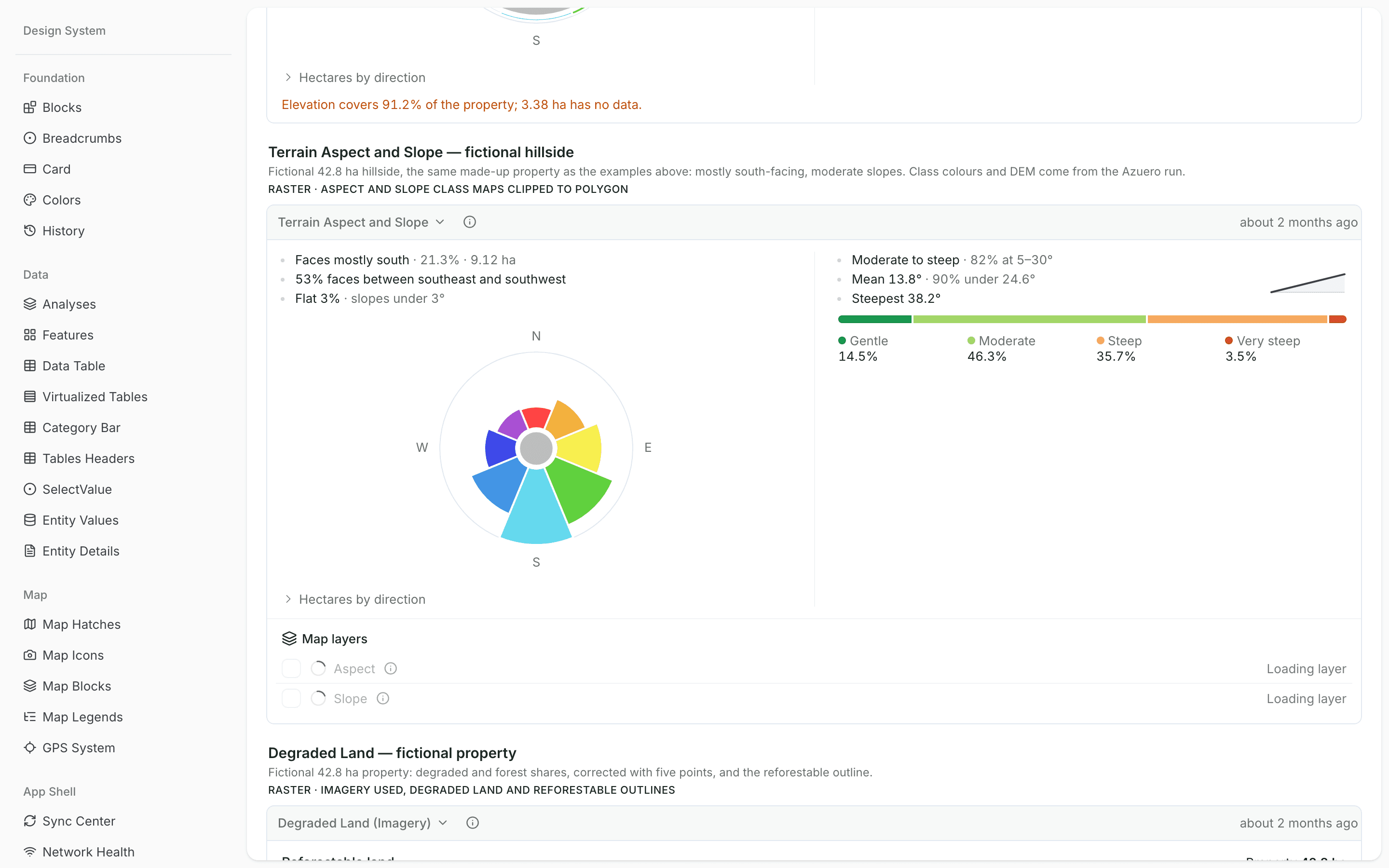
Plan planting and survival assumptions by slope, and keep steep ground in view for access and erosion.
Match species and planting to aspect and slope, and place plots across the range of conditions.
Understand why survival can differ from one part of a site to another.
A property boundary as a polygon, and these settings, which you can change before each run.
| Setting | Default | Range |
|---|---|---|
| Elevation model. Auto uses bare-earth GEDTM30 and falls back to Copernicus GLO-30. | Auto (GEDTM30 bare-earth) | Auto (GEDTM30 bare-earth) · GEDTM30 bare-earth · Copernicus GLO-30 (includes canopy) |
| Slopes gentler than this count as flat instead of facing a direction. | 3 | 0–15 |
By OpenGeoHub

How the analysis uses it
The default. A bare-earth terrain estimate from Copernicus GLO-30 and ALOS AW3D30 elevation, corrected to the ground with ICESat-2 and GEDI lidar.
Cite: Ho et al. 2025, PeerJ
By European Space Agency, German Aerospace Center (DLR) and Airbus



How the analysis uses it
A surface model that includes the height of trees and buildings. Used only when you pick it or GEDTM30 cannot be read.
Run it at site planning, once a property is chosen. Aspect and slope feed species choice, planting density, survival expectations and where plots go.
Slopes that face the sun through the dry season dry out sooner, and seedlings there can survive less often. Which direction that is depends on latitude and season, so the analysis reports all eight.
Surface models measure the top of trees and buildings, so slopes under forest follow the canopy. A bare-earth model estimates the ground beneath, which is what water and roots follow.
Yes. The default is 3°; you can set anything from 0° to 15° before a run.
A property boundary as a polygon, drawn on the map or imported from a KML, shapefile or GeoJSON file. The result is saved on the property, beside its other records and maps.
Updated
Tell us about the properties you are looking at, and we will set the analyses up in your project.
Bring in the spreadsheets, field forms and maps you already use, and see every site in one place.